The Wampanoag Canoe Passage June 9-12, 2012
Otherwise known as “A Fine Bait and Switch” or “A Ludicrously Optimistic Plan”
Introduction: I have the old topographic maps from Troop 66 Scoutmaster Thomas Clark, who researched and initiated this effort to “rediscover” the Wampanoag Canoe Passage some 35 years ago. They have his original notes in red pencil: where to put in, where permission to portage was needed, and where to camp. They trace a red line from the North River to brook to ponds to streams and describe and arc that became our narrative in the late 1970s. I remembered putting in at Pantoosuc off of Route 53. I have some of the old photos from the time. In one of them, Tom Clark and two other scouts are canoeing through a line of bushes towards a beach. All three of those individuals are now deceased – Tom after a long and fulfilling life with much generosity to others – the other two boys much too young. Time passes. But the waters flow much the same as they did back then.
There are, however, a few changes. After rainfall, the increased level of impervious surface from roads and rooftops results in more immediate runoff and less absorption and hydrological release. All things equal, you get either higher or lower water levels, depending on how recently you have had rainfall. With a dry spring behind us (even with recent rains) water levels were lower than normal.
The thin red line of Tom Clark’s red pencil now becomes a thin blue line showing a theoretical watercourse on an iphone. And GPS can show slow and painful process through even the thickest swamp. But it cannot keep you from getting lost, as I proved on Day 2.
Day One: The Driftway to Old Bridge Street Stone Bridge:
Day One saw us gathered at the Driftway at noon, with a fair contingent ready to paddle upriver with the tide to the Washington Street Bridge in Hanover. Three kayaks, three canoes, and high spirits under a beautiful June sun with a light breeze in the high 70s, and an easy paddle past the historic landmarks. One of the paddlers who would be with us for the full trip, Tom Flaherty (who grew up in Scituate) yelled out to some boaters that we were headed in the general direction of Rhode Island. That makes for an impressive claim, and one sure to raise curiosity. Fun conversation and easy paddling, with a nice leisurely break at Couch Beach punctuated a day with few drawbacks. Except for the mice.
That morning I chose my canoes, looking for lightness and durability (more on that later). One was a fiberglass Katahdin. The other was a longer aluminum Michicraft. It was also a mouse condominium. The first mouse jumped out at NSRWA headquarters when Tom and I lifted the craft onto my truck. The second one hitched a ride with us to the Driftway (after showing up in the back of the truck first at Tom’s brother’s house, and then at mine. The third showed up at the Driftway when we submerged the canoe to rid it of mouse feces. It popped out, bumped against Tom’s leg, swam to shore, and hid in the overhang of the marsh.
And all three left us a remembrance: dry mouse poop is one thing. Like outmeal or plaster of paris, it acquires a quite different characteristic when wet. It smells like a mixture of many things, including manure and urea. So when Samantha Woods, Executive Director for the NSRWA, paddled by us a few miles upriver, she commented that we must have just paddled by some manure. I assured her it was just us. The smell left us after the third day, but each time we got water in the canoe, nasty brown effluent seeped from the forward and aft flotation cavities. We got a lot of water in the canoe…
Afternoon saw us at NSRWA members' Mike and Mary Moyer's house, and Mary graciously hosted a kick-off cookout for us. In retrospect, this felt somewhat akin to the early stages of the Hunger Games where everybody is wined and dined to the max before the real fun begins.
Day Two: Washington Street Bridge in Hanover to Mountain Ave. in Pembroke: The first night, we slept at home, leaving at 5:30 a.m. the next morning to drop the truck off in Dighton so we would be able to drive the canoes home after our trip. That got us on the water a little after 9 a.m.
Mistake #1: I didn’t listen to Nik Tyack.
Four of us hit the water at 9 a.m. I had my iphone, the topo maps, and a solar charger cum battery, plus three paddlers and two canoes. Though the tide was against us, it was an easy paddle to the Indian Head/Herring Brook split. Nik had warned me not to try this piece, indicating the braided channels were easy to get lost in and time consuming to boot. One year, he got to Route 14 and skipped to Stetson Pond as a consequence. Good advice and 51 years should have given me the humility not to try this stretch, but I remember this being doable 35 years ago, though we had to push the canoe through tight sections of marsh. So I thought I would rely on the GPS and take Tom, co-worker Raphael, and Clay - the 16-year old son of a rowing buddy up to Route 14. I narrowed the scope of the GPS to the channel that crossed Route 14 after passing through Herring Park and we headed up the channel. The blue dot pings on the iphone screen and you know you are following the thin blue line in the direction you set for yourself. An hour later, after cutting through swamp bush, wading in mud up to our knees, and making generally slow going, I realized to my dismay that the blue line did indeed cross Route 14. However, it was not the blue line crossing 14 that we wanted but one that dead-ended about a mile up. So we backtracked pretty quickly (now that we knew where we were going) and found the correct channel. Two minutes later the blue dot informed me that we had just begun to stray off the Herring Brook into the Pudding Brook, so we corrected course and paddled around tight marshy curves, and then ran into thick brush. THICK brush.
The loppers came out of the canoe, and we did too, as paddling became impossible. The going was extremely slow, as we had to cut our way through. The map showed two parallel channel braids, and we only found one, sure that there must be another, deeper one. Traversing the marsh yielded nothing. An hour later, some members of the party became frustrated and suggested we try and find an overland route to the road, whence we could portage our canoes to the park and the next section of the stream on the other side of 14. I headed inland and could not even hear traffic so quickly abandoned the idea. In an effort to boost morale, and give us purpose, I decided to trudge ahead on foot and see if the stream widened or deepened.

THICK brush. In places, you could barely see movement of water, so there was fear of lost channel. In other areas, the overgrowth was so thick, you could not see ahead. In one particularly impenetrable area, the only way to make it through was a space about 18” above the water, which was only 9” deep. So I got down and crawled under the branches for a few yards towards the next opening. This particular moment made me feel for all the world as if I were some hallucinating Spanish explorer, lost in the ‘Glades, searching for gold. The iridescent green and black dragonflies that flew like butterflies added to the beauty and the surreal nature of the experience. And all I wanted was some current… I got back to the group and we decided going forward was better than going back, so we continued to ram the canoes through the underbrush, cut where we needed to, drag outside of the channel through the grass where necessary, and at 4 PM we arrived at the Herring Park on 14. Of the four of us, only I had memories of the other side from 35 years ago, and they weren’t really that encouraging.
Mistake #2: I didn’t call Paula Tyack for a ride.
We surprised and impressed two tattooed gentlemen in a Ford F150 as we dragged the canoes out of the marsh into the parking lot of the park. It might have been the mud we were wearing. Or the biomass in the canoes – all manner of leaves, spiders, and branches mixed with water lay in the bottom of each canoe. It might have been our pronounced destination of Taunton. Or, it may have been the pronounced odor of the mixture of mouse poop, urine, and swamp water distilling in the aluminum canoe. Irrespective, they were impressed, and waved to us when they drove by us hauling the canoes down the street to the next drop-in.
Look at this area of the brook that goes from here to the Mill Pond on satellite view and just try and find water. There is not much. As Nik emailed me today “I warned you.” Warnings are overrated, so we pushed upstream over some downed trees and back into thicket. As a kid, I remember this stretch as being full of spawning lamprey eels, but passable. If you got out and pushed, you could make good time. 35 years later, that was not the case and at times we were overwhelmed with the gratitude of seeing signs of a branch that had clearly been cut by Nik’s team the first time through. It was tough going. Finally at 5 we decided we would go to 7 and sleep at home that night, rather than camp as planned. Two different homeowners saw these folks splashing through mud in the swamp below their houses and we were able to impress them with the word “Taunton,” so some good did come of this section. At 7, we had just reached Mountain Ave. in Pembroke and my wife Julie picked us up with our gear. We tied the canoes off to a small bush and left them in the culvert to go get pizza, beer, and rest. We dropped off Raphael at his car, as he was only scheduled for two days. Dan Shasto was to meet us the next day. Tom Flaherty had two plans for that night. One he expressed to us: go home and go to sleep, hoping the house might catch fire with him in it. (I alerted the Department, as we had two canoes and I would not be able to get an extra body on such short notice). Plan two was to pay another friend to go and find the canoes and destroy them. I didn’t know about this one or I would have alerted the other Department to set up a sting in the culvert.
Redemptive Decision #1: We didn’t pick up where we left off.
While we did not call Paula Tyack, we were able to get Julie and our neighbor with his truck (the same guy who was supposed to destroy the canoes), to take us at 6 AM to Stetson Pond. If Nik could feel OK in past years about cheating our sponsors who had paid for our misery (look up schadenfreude) by a few miles, so could I. We put in at Stetson Pond, quickly paddled through two small ponds, and moved canoes and gear across the railroad tracks to the cranberry bog. This we easily traversed and dropped our canoes into Poison Ivy Brook. Nik told me to avoid this one, too, but I wasn’t quite clear where or how until later.
You won’t find the first part of this on your iphone as a thin blue line of a watercourse, so it doesn’t officially exist. Only by closely studying the waterflow could one tell that there was a direction leading to Monponsett Ponds. I remember this section and the ivy from 35 years ago, but I also remember more water. In some areas it did reach waist deep. I know this because when you cut the poison ivy ahead of you with the loppers and the big leafy branches fall into the water next to you, you quickly start calculating how high the itch line might reach in the coming days. Teknu or no Teknu, there is an unavoidable gift coming your way…
More spiders hitched a ride, more brush fell into the boats, and we slogged forward.
Indications of previous pruning every ten minutes were sufficient to tell us we were not delusional: others had been this way, and finally we reached open sky and Monponsett. Paddling was a strange notion that we had somewhat forgotten by that time, but we quickly got into a rhythm and made it across both ponds, crossing the road that separates them. Another ten minutes across the second pond gets one to Stump Brook. This is a beautiful and wild stretch of strangely green water, as it is fully covered by tiny green plants. It was fun to paddle this stretch, but the iphone map showed that our fun would not last. The map was right.

Stump Brook thins to Branch Brook and then to Twig Brook. And finally to NO BROOK AT ALL. The transition starts with a false positive. As one comes to the end of Stump Brook, the stream actually gets deeper. We stopped to reconnoiter and make our choices and all was quiet, save the constant birdsong and the humming of thousands of bees. The soundscape out there is beguiling and utterly beautiful. The waterscape is nice as well: the stream is covered with a thin layer of green leaves, the water widens, and then stops at a dam. On the other side, waterscape yields to mudscape. To find the thin blue line on the iphone requires zooming in to the most enhanced level, and at this point, two distinct choices emerge: one can follow the natural channel, or the straight lines of cranberry canals. We looked down the straight line to the point where the channel disappeared into the trees. It didn’t look all that promising, though there was perhaps more discernible current. The natural channel was not the clear winner either, but the thin blue line showed signs of widening several hundred yards away into something resembling a pond. At this point, we divined tea leaves, and chose the natural channel.
Looking back, and having seen the satellite images days later, it is still hard to know which may have been the optimal choice. But all of us who tried to paddle the next two hours of marshy landscape would agree that this was an extremely arduous effort. The waterway was choked with plants. Tom, the bowman in the lead canoe spent the next hour or more chopping vertically at the plants with his paddle so that we could lever our way through. It was good to have Dan Shafto along. He had paddled a nice stretch of the Taunton last year with Nik and thought that this year would involve lots of paddling. This was a fine bait and switch.
At one point, even this was not possible, so we pulled the vessels out of the watercourse onto an interesting landscape of two-foot high tufts of grass interspersed with muddy patches.
With two pulling and two pushing, we could make ten yards at a time. On occasion. More often than not, once the boat got past the friction point of the grass, the two lead people would have difficulty moving that fast, while the two behind would continue to drive the boat forward. The result was frequently the same, and always hilarious. The thin bow of the canoe would move past the two lead sled dogs and the wider waist of the boat would exert sideways pressure. They would then be pushed off of the dry safety of the grass and fall backwards into the mud. With nothing to use to get up, sometimes the only remedy was to roll over face first and get up on hands and knees. At one point I saw Dan lying flat on his back struggling to get out of the grass. I laughed, but soon it was my turn. It was dry mud, so it could have been worse. Though if it had been wet mud, perhaps there would have been enough water in the canal to have made the exercise unnecessary. So the lead guys got the most mud time, but not all of the mud time. Once we had the canoe moving so fast and Tom lost his balance in the stern. He didn’t let go, though, and we didn’t see him fall. We were intensely and relentlessly focused on forward progress, so why would we look back unless something was slowing us down. In this instance, our “anchor” was Tom holding tightly to the stern of the canoe as we dragged him across grass and mud. How can one not find comedy in that? At last, we came to the point where the thin blue line on my iphone GPS opened up to a thicker line indicating a pond. But there wasn’t one. Another hundred yards of the same. Then we passed through a culvert.
Finally, though, we did get to Stump Pond, and Elm Street. Here, we portaged on the very edge of somebody’s land, as a little dog came to assail us and the landowner expressed reluctant concern to let us pass as long as we didn’t step on her vinca. The next Pond brought us to Furnace Street and a steep portage off the road back into the canal leading to Robbins Pond. Our rope was a great asset here, as we needed to slow the canal down the hill, and maneuver it between vegetation an old mill structure.
In the first section of Robbins Pond, we made one small false turn, then corrected it, passed by a family of swans, and made it to the portage across to Robbins Pond proper, and Osceola Island. This was where we had initially hoped to camp on Day Two – a ludicrously optimistic plan in retrospect. Passing the Island on the left, we then passed through a culvert into the headwaters of the Satucket River. Mud-walking with the current, we could not quite find water deep enough to paddle. However, we saw some big snapping turtles, the first of many great blue herons, and our hopes rose as the current got deeper and stronger. We had to cross a few downed trees that blocked our path, but nothing to tough.
Redemptive Decision #2: We Stopped At An Appropriate Hour and A Good Location. With an hour or so of daylight, we found a nice and unofficial camping spot at a boat landing on Bridge Street. A picnic table was bolted to concrete so w wouldn’t make off with it, and it served as a nice location for eating and cooking. One of Tom’s friends who is an assistant Scoutmaster stopped by at dark with three gallons of water and a half case of Molson Golden Ales. The latter were still cold and delicious at breakfast on the water the next day. Plus, we needed the carbs.
Redemptive Decision #3: I Brought My Pillow From Home. By now, we were all pretty sore. Our arms were scratched up and our legs looked like maps of the trip, they had so many lines on them. Twelve hour days will wear one out, and sleep is essential, so I was highly pleased to have my own pillow. We all awoke relatively fresh and ready for the next day, and hit the water at 6:30. We hit our first big tree blocking the way at 6:35. And another one at 6:37. 6:40. But then we got to the old Cotton Mill, which as one can read from Nik’s blog, is just a fascinating place and a highlight of the trip. With the rope, we were able to slide our canoes through the sluiceway without actually losing them to the current. The amusing thing here was that once the canoes went over the end, they kind of got sucked backwards with the recycle and came to the spot where the water was now sluicing into them. We had to move the canoes quickly to ensure we didn’t have a lot of bailing to do. Then we canoed under the old buildings themselves, between the old footings, looking at rusted metal and broken windows and trying to remember that at some point this place provided a livelihood for dozens and was part of the financial lifeblood of the town. Not any more.
We floated out of there, and around a bend, and ran into our next tree at perhaps 7 AM. And the next at 7:03. 7:07 7:11. The river is so narrow, and there are so many downed trees that we estimated crossing at least 30.
A few we were able to go under. And Clay, who lived in South Africa, and Saudi Arabia, and couldn’t originally discern the difference between poison ivy and a Christmas tree, was suddenly an expert botanist, yelling to warn me of P.I., or pi, as we came to call it, hanging just over my left ear off of the tree we were pushing the canoe under.
The river is beautiful here, and this would be a very peaceful and serene paddle if there were not trees around just about every bend. Here and there, small armadas of six to a dozen turtles would leave the mudbanks in a hurry as we floated round a bend. Muskrats occasionally ran startled by our presence. Deer appeared at various intervals. A tall tree overhanging the river had dropped blossoms into the current at one point, floating past us like candlelit paper boats my family once saw in Vietnam. Herons flew up and croaked in annoyance at our coming. From the satellite view, housing developments and roads are very near most of the time. But from the river, the dense foliage blocks out most houses and noise, and the brown current moves one along.
The river widens and deepens, becoming the Matfield, and the fallen trees become fewer in number. The goal of completing over 30 miles and reaching Dighton that same day begins to appear possible, and for the first time since the North River we were actually paddlers, canoeing once again. Now the essential question became one of repeating the same stroke thousands of times, and the focus was on covering distance and successfully navigating the small number of rapids we encountered. We were not always successful. A post-trip perusal of the boats shows the fiberglass one with a smashed bow – a result of the Titicut Street Rapids. In addition to that, we had already pulled the bow and stern plates up off of the aluminum canoe where the rivets gave way.

Now in the Taunton, we began to hear and see more signs of civilization: traffic sounds; a tractor on a riverbank; an embarrassment of bridges. This could mean only one thing – that McDonalds was not too far away. We did get to McDonalds at 4:30, re-charged dead phones and contacted the outside world. Back on the water at 5:00 PM, we decided to push to 7:00 and then evaluate our options, with the most likely one being that we would pull out wherever we were, call Dan Shafto’s mother, and get a ride back to the truck. At this point, the tide actually began moving in our favor, but it seemed the wind would have none of it and blew right into our faces for the final two hours of determined paddling. Landscape and vegetation turned from freshwater riverbank to saltwater marsh. The first powerboat appeared tethered to a dock. The Dighton Power Plant showed up to our right. A mile ahead, the Berkely-Dighton Bridge beckoned, and we pulled out at 7:15 as the evening light flattened behind gathering clouds. We had been traveling nearly 13 hours.
We said goodbye to Dan, loaded all our gear into the truck, and drove the backroads home. We crossed the Taunton twice on 44 and 18. 106 brought us past Robbins Pond. A left on 36 took us past Monponsett and once could vaguely discern the swamp somewhere at the far end. Further down 36, we passed Mountain Avenue, where we had hidden the canoes in a culvert just two days ago. It seemed a lot longer. Three minutes’ driving took us to Route 14 and Herring Run Park – a canoe push of almost four hours up the brook. Another 6 minutes took us to the embarkation site for Day 2 at the Washington Street Bridge. A full day’s worth of work (well, including the ‘lost hours’) retraced in 6 minutes. Another 15 minutes got us to the Driftway. We stopped at the lights at Tilden and Beaverdam. The lights turned green and suddenly I had absolutely no idea where I was. None. I looked at Tom and asked “where are we?” “My house”, he said, and mine was only one more house further down the street. Four days, 70 miles, countless strokes, numerous scratches, and many bad jokes. We were done.
Miscellany and Other Observations:
*Nearly 72 hours later, I am thinking about next year. A week or two ahead, I would spend a day with loppers coming DOWN from the Herring Park. That part of the trip is a must.
*I have tremendous respect for Nik Tyack. Three years in a row is an amazing feat, and year one must have occasioned many doubts as to whether he was on the right path during parts of the trip. I had them, and they would vanish when I found the lopper marks from cut branches left by his party. I more than once uttered a quiet thank you for those who had been there “wamping” before us.
*If the Wampanoags used this whole waterway at all frequently, it would have been in a time of different hydrology and landscape. Certainly they would have kept the passage clear. And yet, one could traverse this much more quickly on foot. Howard Russell’s Indian New England Before the Mayflower refers to footpaths often only one to two feet wide and ‘worn deep by the passage of countless thousands of feet over centuries. A fleet messenger might press a hundred miles or more over them in a single day.” One still discernible path from Connecticut to Providence is two feet deep in certain areas. Clearly, the land routes were known and well utilized. IF water was used, it would probably have been for trade of heavier goods. Ships are the most efficient way of moving bulk today. Canoes would have been hundreds of years ago. But even then, summers would have been dry and winters frozen. “As a result, paths were likely to follow alongside the principal water courses.” “In southeastern Massachusetts, the Taunton River and its tributaries, their courses heavily populated, were all paralleled by footpaths…Another way, now Route 44, led from Plymouth West to the head of Naragansett Bay.”
*There is a tremendous sense of satisfaction and accomplishment in having completed the journey. What’s more, having hiked fifty-milers in Vermont, hitch-hiked Africa for four months – including a weeklong traverse of the Mountains of the Moon between the Congo and Uganda, traveled with a team of Frenchmen and Somalis along the tip of the Horn of Africa (with a fish-eating camel), and rafted in northern Quebec, I have some experiences to compare this to. I can confidently state a surprising fact: none of these other experiences can surpass in challenge, difficulty, or beauty what w have here in our own backyard. This cannot be overstated. If you want a hardcore challenge, it’s waiting right here for you.
*The poison ivy spreads further across the body before it recedes and a well-constructed dike of TekNu is not entirely enough to stop it. Long pants and shirt are advised.
*Eat often and drink tons of water. You are burning calories and dehydration is a risk.
*The humor emerges as the event recedes. Stuff gets funnier. Tom’s comment “I was hoping the poison ivy would swell my eyes shut” so I wouldn’t be able to paddle today becomes epic. You remember little vignettes you thought you forgot.
*I could have spent four days doing the same things I do over most days, and 35 years from now, I would have no memory of it. If life is about writing a meaningful narrative full of good relationships and accomplishment, this is a hell of a chapter.
*We raised close to $6,000 for the North and South River Watershed, whose work is so meaningful in protecting the riverine jewels that surround us.
*I have a renewed appreciation and respect for Tom Clark and Lee McKenny, our Scoutmasters who led us on these trips some thirty five years ago. I kept thinking: “how did Tom do it with these topo maps? How did he find out about it in the first place? And how did he motivate us all to keep moving forward and go so far over a long Memorial Day weekend.
*And I remember and treasure Tom’s memory and those of the other fathers and scouts who paddled with us. This trip actually made me physically remember the laughter and voices of Tom Clark, Scott Robbins, and Jim Jelinek, who were taken from us way too soon. Tom, Scott, Jim, you were with us out there. We’ll see you again.
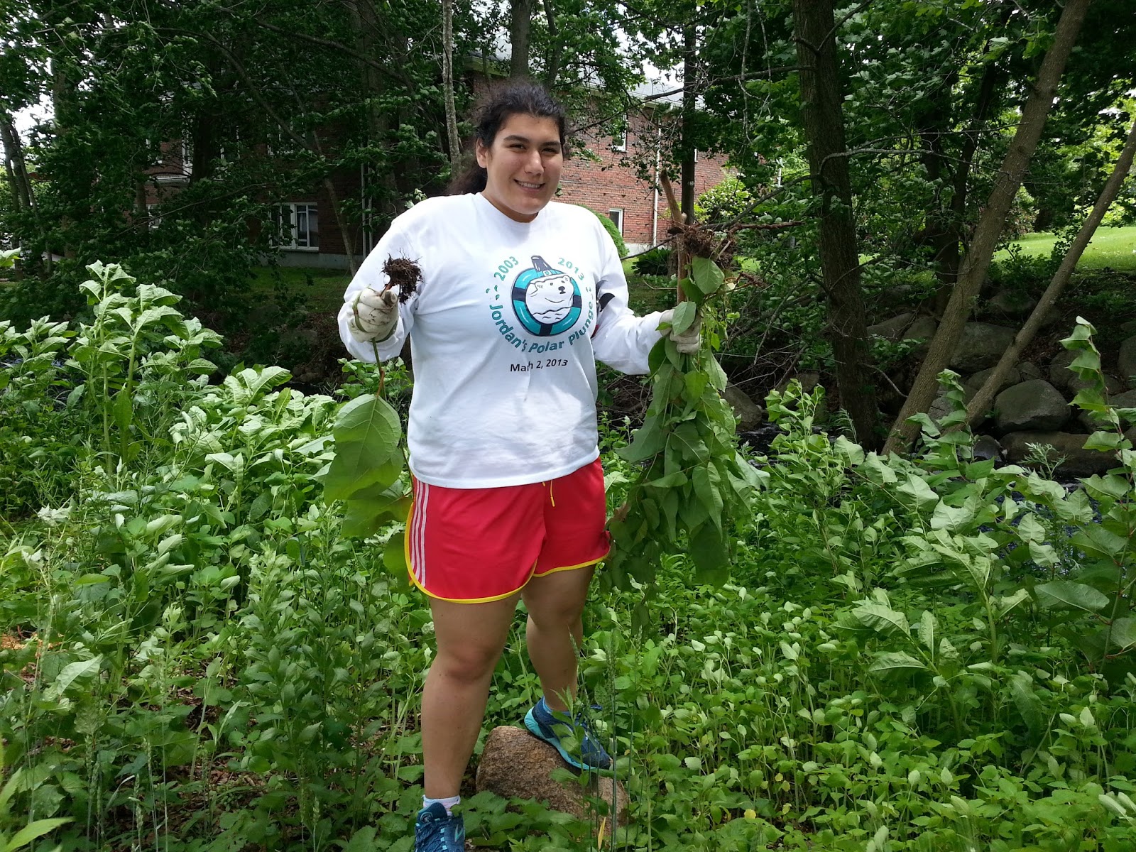
 Through my internship, I had the opportunity to work on a variety of field projects with ecologist Sara Grady. Fellow interns Margo, Sara, and Alex and I assisted with multiple projects including collecting samples for an ongoing experimental study of dock shading impacts, analyzing samples to determine the ecological effects of harbor alterations, and completing surveys of Phragmites and other invasive species in the surrounding harbors. While the summer began with Sara patiently instructing and informing us on proper techniques and scientific names, we gained the knowledge and confidence to conduct the surveys independently. Not only have I successfully developed navigation skills necessary to get me to the various locations, but I can also correctly identify Japanese knotweed invasive species while driving!
 A significant aspect of my internship was conducting the preliminary research for potential shellfish restoration in the North and South Rivers. Historically blue mussels (Mytilus edulis) had a significant presence in both rivers, but there are currently significantly decreased populations. I conducted field surveys to determine current shellfish populations in the North and South Rivers, held interviews with government officials regarding existing regulations, and discussed the experiences from similar restoration projects in the Bronx River and Martha's Vineyard. The information I gathered will be used in NSRWA's efforts to establish new blue mussel populations in the rivers for water purification and habitat remediation. My research exposed me to the complexity of federal regulations surrounding water resources and the influence of minor changes in ecological factors. It was fascinating to gain an understanding of the necessary steps for such a project, and I look forward to following NSRWA's development of this project in the following years.
  I greatly value the friendships that I made during my internship and owe a great thanks to all those who assisted me throughout my time with NSRWA. Sara H., Alex, Margo, and I had a lot of fun throughout the summer, from playing with squirt guns at the Great River Race to frequent ice cream stops after working in the field. Janet Fairbanks, Joe Stradzes, and Russel Clark deserve additional thanks for providing their time, knowledge, and boats that allowed me to conduct the necessary studies in my research of existing shellfish habitats. I am so grateful for my experience with North and South Rivers Watershed Association and look forward to hearing of the continued successes of the organizations and other interns. It's not a 'goodbye' as I leave for college, it's more of a "I'll see you soon' and I can't wait until the next time I'm on the rivers.



.PNG)


